Caribbean Guatemalteco and Peten
QUIRIGUA From Guatemala City I drive down CA-9 highway that snakes its way between the Sierra de Minas and the valley of the Motagua River to the Caribbean shoreline.
I sit behind the wheel for 210 miles before reaching to the Quirigua archeological site, declared Heritage of Mankind by UNESCO back in 1979. I wonder whether this used to be a place carpeted by deep jungle in the past, but only a few patches of woods hem in the Mayan ruins today. The rest of the land is covered by huge banana plantations that once belonged to the United Fruit Co., the same U.S. company that pulled some evil strings locally during a considerable chunk of the 20th century. Nothing was known about Quirigua until the year 1839, when John Lloyd Stephens, an American scientist who was wandering around the premises to study the steles of the neighboring Mayan city of Copan (Honduras), dug it out for all the world to see. The discoverer couldn't help but being a hostage of his own time and asked the owner of the steles to sell them to him just to take them back to New York.
Fortunately, a bickering over the price let the steles remain in the same original place where they've always been.
In Quirigua, travelers can gaze at the most important cluster of Mayan steles in Guatemala and only second to Honduras' Copan in the Americas, just 40 miles away from each other. There's absolutely no doubt these were two pre-Hispanic villages closely related to each other. Most of the time, Copan managed to reign over Quirigua. But in the 8th century –under the kingdom of Cauac Cielo- the town fought against Copan and captured the monarch, who was eventually executed in 737 A.D.
One of the steles was probably linked to human sacrifices. Mayan people used to be very educated, yet very fond of giving human lives away. Those sacrifices are cleverly represented in symbols of stars, gods, monsters and other creations are the carved centerpieces.
Like all politicians since the dawn of time, Cauac Cielo wanted to leave a legacy of his own in glorious monuments and emblematic buildings. That gave rise to the construction of a fourth 65-ton stele that rose 10.5 yards high (stele E is the biggest ever unearthed in the Mayan world), plus an acropolis and a ballgame court.
The city spent a century of prosperity. Then, it started to decline until its mysterious disappearance like the rest of the Mayan hamlets. There's need now to underscore that the Mayan civilization, that ruled for approximately an entire millennium, crumbled down in 810 A.D. without a reasonable trace for today's archeologists to cling to and understand why all Mayan cities collapsed almost at one fell swoop. Even some of them –like Tikal- once had 100,000 inhabitants. Their huge pyramids and palaces were gobbled up by the jungle until quite recently when they began to lay bare their secrets.
These steles are really interesting. My excellent guide, Roberto Guillen, taught me to figure out the numeric symbols. Experts decipher the entire date (day, month and year) in the twinkling of an eye. Of course, there are still plenty of mysteries to be unraveled because each and every block is packed with signs and puzzling hieroglyphics.
PUERTO BARRIOS Leaving Quirigua behind, we head for Puerto Barrios along the Caribbean coastline. Puerto Barrios was founded in 1880 with a goal in mind to make it the most vital harbor for the export of bananas. Nonetheless, those operations are now conducted in a newer port facility standing a few miles away from the town.
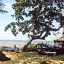
The waters of the Guatemalan Caribbean are not the traditional postcard-style turquoise blue we all hope to see. This is a shoreline where vegetation usually melts into the water, where beaches are not that long and dark blue is the color of choice for the sea. The landscape is marked by a wild beauty, just to put it this way.
Puerto Barrios remains anchored in a lifestyle that brings back memories of some of Garcia Marquez's novel settings dominated by motley houses and a port-like atmospheres.
However, the drive of the leisure industry allowed the recent opening of a tourist compound made up of a lovely 60-villa resort and a marina with docking room for 180 yachts. The five-star compound will turn out to be a key port location because Guatemala's Caribbean coastline can only be reached by sea. For its part, Puerto Barrios has a great connecting road and a fair airport (flights to the city take just 45 minutes).
Facilities at the Resort & Marina Amatique Bay Hotel have been built in the purest Spanish colonial style, caught inside a gorgeous natural environment and taking advantage of one of its scarce beach strips of white sands that dot its Caribbean coast. For further information, please click on www.amatiquebay.com
Puerto Barrios takes center stage in Amatique Bay –a gully of warm and crystal-clear waters teeming with natural, historic and cultural attractions. A case in point is Belize Keys –with the classic turquoise-blue color you're probably looking for- that stand some 65 miles away, and the mystic Garifuna population of Livingston, just 22 miles away.
LIVINGSTON One of the best tourist choices is to sail off from Puerto Barrios alongside one of the world's most spectacular coastlines. We take a northbound trip and just a few minutes later I make out some hills brimming with abundant vegetation that slope all the way down to the seashore. Leafiness is so heavy that there're simply no roads. The fact that this piece of Eden-like land is completely shut off from the mainland is what really makes it so attractive. Here you can find tiny gullies and beaches engulfed by the most soundless solitude.
We cruise by the Cayos del Diablo, former haven of devilish pirates, and sail on pleasantly. Seagulls and other birds are the masters of the environment here as they fly in flocks not far from my boat, diving and fluttering their wings up in the air again.
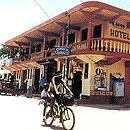
In the middle of this amusing boat ride, we make out Livingston with a population of 4,000. That place can only be reached by sea or taking a ferry down the river. It's located in the estuary of the Dulce River that flows into Amatique Bay. There are no roads, no airports. For travelers coming from cities where cars seem to outnumber residents, being in Livingston is quite a shocking experience.
Garifunas are part of a very unknown civilization formed by black Caribs, a blend of Arawaks and Africans. Their tongue is a hybrid of Afrikaans and Arawak, plus some contributions made by French, English and Spanish. We can say their language is a compilation of the entire Caribbean history.
In the mid 18th century on the island of Saint Vincent, runaway slaves who had rebelled against their British masters, mixed with islanders and founded independent communities. They fought with might and main only to be beaten at the end of the day and deported to the Islands of the Bay in Honduras. From there, they moved out to Central America's east coast. By 1800, Garifunas were living from Belize to Nicaragua.
Guatemala's Garifunas gathered in Livingston, where they remained in complete isolation until 1996 when the government officially recognized the importance of the Garifuna community.
The Garifuna civilization is mighty and stresses on music, dancing and history. They've got a religion of their own, a mixture of Catholicism, African rites and Indian creeds. They like reggae and you bet the atmosphere resembles very much that of Jamaica as you see scores of youngsters with a Rastafarian cut of their jibs.
Their economy hinges on fishing. The town appears to be quite peaceful to me and urges travelers to traipse around the corners. By the way, residents here are friendly and make no buts about having pictures taken.
I loved the food. The traditional dish in this neck of the woods is the tapado, a shellfish soup with the addition of coconut, banana and cassava to give it a sweet taste. I have a good serving of tapado at the Margot restaurant.
Not far from Livingston, there's a place dubbed the Seven Altars. The number matches the exact amount of natural wells and small waterfalls made by a rivulet before flowing into the sea. The half-hour barge ride plus the hike into the small river's watercourse give me the chance of taking a good swim under the very last fall.
RIO DULCE I never thought I could possibly find something like that. As soon as I left Livingston, the Dulce River crosses some breathtaking gorges. On both sides, climbing perpendicularly from the surface up to 200 or 300 yards, you can make out a wall carpeted with green life.
Trees grow by the riverbank with heavy twigs that seem to have no end. Forget about trying to catch a glimpse of the top of the trees. As we sail on, the boats start getting perfectly trapped inside a forestry wall in which beauty and grandeur are the name of the game.
Under that appalling greenish landscape. Roberto –my guide- pinpoints a place by the bank where I can find a spring of thermal waters. I jump into the cold water and notice the temperature starts rising as I get to the rocky wall in search of the right spot to swim around. I could stay here for forever more, but the night closes in and I must leave for my new destination at the Izabal Lake.
Dulce River is the natural drain of this lake of 50 kilometers long by 20 kilometers wide. The watercourse runs down 42 miles from the lake all the way to the sea. Even though the last segments of the river are kind of boxed in, it suddenly opens to a width of 9 kilometers called here El Golfete (The Little Gulf). The surroundings are blessed with a varied wildlife and great biological wealth hedged by mangrove thickets and jungle patches. One of commonest animals here is the manati or sea cow, a herbivore marine mammal that's been labeled as an endangered species for quite some time.
At the end of the river and just when the Izabal Lake meets the eye, the gracious San Felipe de Lara Castle pops up. The fortress was built to prevent pirates from walking into Guatemala's hinterlands and to protect the stashed goods bound for Europe. The first tower was built in 1595 and several additions were made through the years in an effort to ward off pirate attacks.
I keep on daydreaming by the bank of the river as I gaze at a breathtaking sunset from the wharf of the environment-friendly Izabal Hotel. The farewell tour down Dulce River has really made this the pinnacle moment of the trip to Guatemala. What really makes this country such a fascinating land is precisely the contrast among the tableland, the Caribbean and the Peten area. Only a few places aboveground boast such a great combination in so small a space.
TIKAL Even though I'm halfway from the small village of Rio Dulce –named after the river and also known here as Fronteras (Frontiers)- the road spanning the location and Tikal is in pretty good shape and turns the trip back to the capital into a seven-hour drive. It's a whole lot better, though, to give a crack at it by air from Guatemala City's Flores Airport.
The flight takes an hour. I arrive in Flores with plenty of time in my hands to have breakfast at the lakeside Peten Splendid Hotel, a good moniker to dub the entire area.
Peten is a somewhat plain jungle-like area that takes up most of northern Guatemala and hides some Mayan gems inside. Tikal is the one place where Mayan architecture reaches the highest expression of a fantastic natural environment. There's a 70-mile stretch from Flores Airport to Tikal that takes a one-hour drive down a well-paved road.
Tikal's archeological core was dug out during the 19th century by a group of so-called chicleros, workers who used to pry out the resin of rubber trees for making chewing gum in a toilsome process that remained unaltered until the 1970s. Though the first-ever scientific expedition was dispatched in 1848, excavation works didn't start until 1956. Since then, huge efforts have been made to rescue the masterpieces of Mayan architecture from the claws of the almighty jungle.
There's still a long way to go as experts suspect there are thousands of deposits down here . A tour around the area gives away some buildings waiting to be explored.
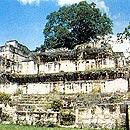
I approach the Temple I and the Grand Plaza, the very first stunning look of Tikal. Under this Temple, dubbed the Giant Jaguar, a powerful king named Ah Cacau was buried. The well-known Temple II (known as the Masks) lies across from the monarch's grave to hold the remains of Ah Cacau's wife. The plaza's east side is dominated by the North Acropolis with its eight funerary shrines, and farther across is the Governors' Residence.
Hemmed in by such magnificence, I sit down on the lawn of the Grand Plaza for a pause and a look. A group of Mayan Indians is making a copal incense altar to pay tribute to their ancestors. Some tourists try to climb the 38-yard-high Temple II and at the end of an exhausting flight of stairs they enjoy the view which is even more astonishing from the Two-Headed Snake of the Temple IV, the tallest pre-Hispanic Mayan building. The amount of construction materials used here was immense; suffice it to say that the temple perched atop the hill is made up of 10-meter-wide walls.
Regardless of recorded evidence proving Tikal's occupation for 15 long centuries, experts have been able to trace a 577-year background thanks to the untold testimonies of the standing stone steles. According to them, the kingdom's gold age came to pass between the years 250 and 850 AD. The city was abandoned by the year 900.
There are two museums in Tikal, one in the downtown area and a second one called Sylvanus Morley, featuring over 100,000 different artifacts and ceramic pieces, personal decorations and tools recently dug out on the premises. A replica of Au Cacau's grave is one of the standing elements, including its original stele (number 16) that really packs a wallop.
For Mayans, yax was the green color and dawn, the image of light invading this huge vegetation sea and reflecting several greenish shades.
The Guatemalan Caribbean awaits us with puzzling cities of monumental beauty and amazing natural landscapes.
The city of Livingston is the cradle of the Garifuna civilization, a blend of Arawaks, insular Caribs and African slaves.


