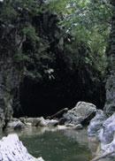
The Santa Cruz River Canyon
Less than a mile from the Ciro Redondo community, in the San Cristobal municipality and known among the local population as Cinco Pesos, right in the heart of the Sierra del Rosario, Pinar del Rio boasts one of its most noticeable unevenness: the Santa Cruz River Canyon.
Once you get to the Las Lajas Viewpoint, lying next to the mountain road that leads to Mundito Ranch, you'll chance upon a valley formed by a watercourse that elbows its way through a number of limestone territories. The course cuts through a narrow gorge that has been for years used by the local population that lives in this far-off spot to get down to the southern lowlands.
The watercourse is named after a former cattle ranch that used to be perched on the southern plains. Up in the Rangel Peak, you can make out the waters that come down from plentiful springs and flow into the valley.
From the spectacular viewpoint, the brushes of nature splay an assortment of colors and shades on the local vegetation that grows everywhere. There are some formations that depart from the evergreen woods all the way to the round-top hills, with hanging vines that climb white, ocher and yellow vertical walls. A mixture too hard to be painted, not even by those skillful fine artist who love making their masterpieces for the whole world to see.
The downhill takes a long and easy-to-walk path that slinks down the steep heights, crevices and peaks, letting visitors take a peek at some of the croplands below that local hicks plant for a living. Most fields are pretty close to the rustic and intimate houses where hikers may stop over for a while. In those houses, travelers are invited to share countryside traditions. A great moment for a good rest or just a sip of water.
Some 3 miles later, we get to the river banks. The first impression makes us believe that down the river, the watercourse was not able to carve a limestone rock hedged with vertical pavilions that nearly reach 1,000 feet high and crowned by 1,600-plus-foot mountains, giving the scenery a touch of majesty worth contemplating.
From the pavilions, trippers may match different layers where a long time ago, waters used to run down, taking advantage of existing fissures, faults and cracks. Erosion has inch by inch carved a limestone rock into the kind of natural formation it is now.
Each and every bend in the road has a new spectacle in store for us. For a moment, both walls seem to come closer together, forcing hikers to turn to the only two possible alternatives: the first one –suitable for mountain climbers- requires visitors to walk on the edge of the canyon, sauntering past the natural pools that are lined up in rows along the way. The easy way out, however, is to swim your way to the other side. The most memorable stops will be Cana de Ague, El Indio and Quite Cal zones. The latter –the riskiest of all- consists of a ditch whose walls and bottom are tiled with small layers of limestone pebbles. The vertical walls come together, leaving only a 7-foot-wide crevice to walk through. The dark color of the bedrock gives away depths of more than 10 feet.
Along both banks, there are countless caves of different sizes, ranging from small cavities to huge caverns. The story has it that back in 1984, the human remains of a runaway slave showed up in one of the caves, some 32 feet above the watercourse level. The body showed marks of an infectious disease and other torments that probably caused the death of this man.
Among the most important underground passages in the area, there are two caves: Tres Nombres and Los Perros. The first one trapped as group of cave explorers inside for three days in 1984 as a result of a flooding. Fortunately, the team managed to camp out in a portion of the cavern where the waters never reached them.
At the end of the trip, a spurt of fresh water springs up nonstop from the huge woodlands, as if the mountains were bringing up the best of them to thirsty hikers as a friendly farewell to this unforgettable journey.
The environment offers not only the canyon, but also an entire region full of legends, stories, histories and highly valuable unevenness. Thus, the Abreu Canyon comes to sight, named after a brook that comes down from it and flows into the southern lowlands, making up seven fossil falls down a narrow path of barely 9 feet wide beautifully carved in the rocks. The beauty of the surroundings is simply amazing, dominated by tall pool trees (Ficus so.) that, bent on surviving at any rate, have used their roots to weave astounding nets onto the rocks.
The rugged topography of the defile above was used by runaway slaves during the colonial rule. Sooner rather than later, this coarse terrain became of their major strongholds in the area. This was precisely the place that hid the whereabouts of Madre Melchora and her squad, a larger-than-life runaway woman slave that threw her hunters off the scent in countless occasions.
The Santa Cruz River Canyon is by far one of the most puzzling and paradise-like spots of Pinar del Rio's geography, a place where scholars, historians, naturalists and artists have made their wildest dreams come true.


